Difference between revisions of "Falsterbo (HL)"
Sarna News


m (→Falsterbo IV) |
(added flag) |
||
| Line 62: | Line 62: | ||
* [[HDF Manufacturing Factory Complex]]<ref name=OTP:HCp4/> | * [[HDF Manufacturing Factory Complex]]<ref name=OTP:HCp4/> | ||
| − | + | == Image gallery == | |
<gallery> | <gallery> | ||
| − | + | Hanseatic League 3079.jpg|Hanseatic League as at 3079 | |
| + | Falsterbo flag OTPHC.png|Planetary flag of Falsterbo | ||
</gallery> | </gallery> | ||
Revision as of 22:32, 12 November 2020
This article needs to be updated with material from Operational Turning Points: Hanseatic Crusade. Once these titles clear the Moratorium period, or if they already have, please consider revisiting this article and updating it with the new material. |
Note: X and Y are coordinates (light years on XY plane) relative to Terra at (0, 0)
| Falsterbo | |
|---|---|
← 3135 3151 | |
_3151.svg) | |
| System Information | |
| X:Y Coordinates | -771.938 : 844.05[e] |
| Spectral class | K3V[1] |
| Recharge time | 194 hours[1] |
| Recharge station(s) | none[1] |
The Falsterbo system is the location of at least one habitable world or construct and as at 3079 is located in the Deep Periphery nation known as the Hanseatic League.[2]
Contents
System Description
The Falsterbo system is located near the Anklan and Bremen systems.[2]
Political Affiliation
Falsterbo IV
Template:InfoBoxPlanetStandard
Planetary History
Planetary Rulers
Military Deployment
Geography
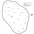
Planetary Locations
Industrial Centers
Image gallery
Hanseatic League as at 3079
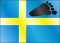
Planetary flag of Falsterbo


Nearby Systems
| Closest 20 systems (4 within 60 light-years) Distance in light years, closest systems first: | |||||||
|---|---|---|---|---|---|---|---|
| Bremen | 42.4 | Bruges | 45.0 | Kalmar | 55.9 | Dorpat | 56.7 |
| Elbing | 64.9 | Kampen | 70.9 | Dortmund | 72.7 | Lübeck | 73.5 |
| Braunschweig | 84.6 | Köningsberg | 85.2 | Riga | 92.9 | Novgorod | 97.5 |
| Bergen | 102.2 | Antwerp | 105.8 | Anklan | 110.5 | Visby | 110.9 |
| Stettin | 113.1 | Tomalov | 124.8 | Wismar | 125.8 | Danzig | 129.1 |