Difference between revisions of "File:HanseaticMap.jpg"
Sarna News


Dirk Bastion (talk | contribs) (Categorising) |
Csdavis715 (talk | contribs) m |
||
| (2 intermediate revisions by 2 users not shown) | |||
| Line 1: | Line 1: | ||
{{Image summary | {{Image summary | ||
| − | | summary = [[ | + | | summary = Position of the [[Hanseatic League]] relative to the [[Inner Sphere]] |
| − | | artist = | + | | artist = |
| − | | source = [[Explorer Corps (sourcebook)]], | + | | source = ''[[Explorer Corps (sourcebook)|Explorer Corps]]'' (1996), p. 48 |
| licensing = {{Fair use}} | | licensing = {{Fair use}} | ||
}} | }} | ||
| + | |||
[[Category:Maps Gallery]] | [[Category:Maps Gallery]] | ||
Latest revision as of 13:20, 6 October 2023
HanseaticMap.jpg
| Information: | |
|---|---|
| Summary | Position of the Hanseatic League relative to the Inner Sphere |
| Artist | Missing artist |
| Source | Explorer Corps (1996), p. 48 |
| Licensing |
|

File history
Click on a date/time to view the file as it appeared at that time.
| Date/Time | Thumbnail | Dimensions | User | Comment | |
|---|---|---|---|---|---|
| current | 00:11, 24 August 2009 | 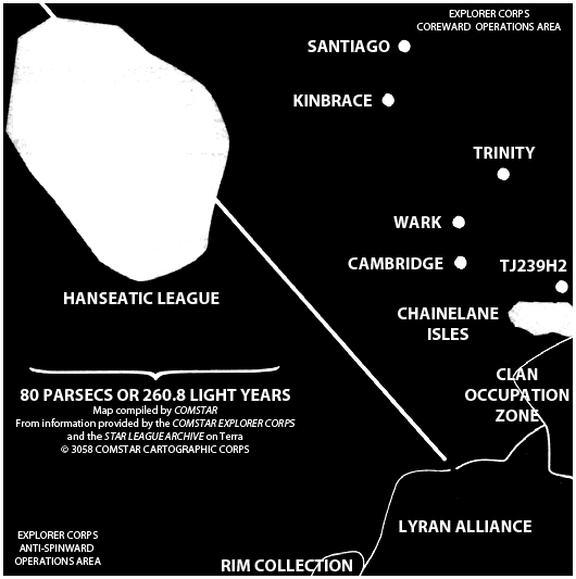 | 530 × 533 (106 KB) | S.gage (talk | contribs) | Map adapted by S.gage from a map founded on pg. 48, Explorer Corps (sourcebook). Fair Use. |
You cannot overwrite this file.
File usage
The following page uses this file: